Urban infrastructure engineering encompasses the evaluation of both present and emergent city infrastructure requirements and the design of the transport, water, energy, waste, drainage and accommodation systems necessary to keep the city safe and functional and to ensure it complies with environmental, social and economic standards.
Cities are home to 45% of the world’s population in 2025 and two-thirds of global population growth through 2050 is projected to occur in cities.
— UN DESA, World Urbanization Prospects 2025.
That scale of growth is why this discipline matters so much. Cities don’t usually collapse because nothing got built — they struggle because what was built wasn’t sized for what the city eventually became. Rapid urbanization, growing population, increasing demand for infrastructure, deteriorating traffic, more stringent water and sanitation requirements, escalating climate risk: these pressures manifest themselves collectively, and not one-by-one, and are not willing to wait for a master plan to be developed. Infrastructure would need to be planned in anticipation of growth, rather than haphazardly created in response to it.
What Is Urban Infrastructure Planning?
At its core, urban infrastructure planning answers one recurring question: what will this city need, and is anything being built to meet it? The objectives follow from there — assess present and future demand, coordinate the systems that meet it, sequence investment sensibly, and keep everything running decades after construction wraps up.
The scope is broader than most people expect. Transportation, water, energy, drainage, solid waste, digital connectivity and public services all fall under it, and none of them work well planned in isolation. Build a transit corridor without matching water and drainage capacity, and the city’s problems don’t disappear — they just move somewhere else.
Urban infrastructure planning gets confused with urban planning fairly often, and while the two overlap heavily, they aren’t the same thing. Urban planning decides how a city grows: land use, spatial layout, where housing, commerce and industry sit relative to one another. Urban infrastructure planning picks up from there — figuring out what needs to be built and connected to support that growth once the pattern is set. One shapes the city. The other makes the shape work.
Urban Planning vs. Urban Infrastructure Planning
Urban planning vs urban infrastructure planning work together but focus on different aspects of city development. Urban planning determines how a city expands and operates, and infrastructure planning makes certain that the systems and services necessary to accommodate that expansion exist.
Urban Planning | Urban Infrastructure Planning |
Focuses on how urban areas develop and function | Focuses on infrastructure needed to support development |
Land use and development patterns | Transportation, water, energy, drainage and utilities |
Defines spatial growth | Plans infrastructure capacity and connectivity |
Considers communities and land use | Considers infrastructure systems and services |
Provides a long-term city development framework | Provides an infrastructure investment and implementation framework |
Short-term planning usually chases whatever’s visible right now — a congested junction, an overloaded pump station. Long-term infrastructure planning is a different exercise entirely: it sizes systems for a population that doesn’t exist yet, which is precisely why it’s harder to get right, and why cities tend to regret cutting corners on it first.
Why Is Urban Infrastructure Planning Important?
Poorly planned infrastructure rarely fails all at once. It shows up gradually, as a city outgrows systems that were never built with this much growth in mind:
- Population grows faster than the systems meant to serve it — Capacity planned for yesterday’s headcount runs short well before the next upgrade cycle.
- Expansion sprawls outward without services following — New neighborhoods go up before roads, water and power reach them.
- Traffic congestion compounds year over year — Added vehicles without added transit or road capacity simply stack delay on delay.
- Water shortages hit neighborhoods that were never on the original supply map — Distribution networks built for a smaller footprint can’t stretch to cover new growth.
- Flooding shows up in areas that used to drain fine —Drainage capacity was never resized as the ground around it got paved over.
- Waste management strains under volumes nobody planned for — Collection and treatment systems sized for a smaller population fall behind quickly.
- Energy demand climbs past what the grid was built to carry — Outages and brownouts become more frequent as load outpaces capacity.
- Public services thin out across a population that’s outgrown them — Schools, clinics and emergency services serve more people than they were designed for.
- Climate risk stacks on top of all of it — Turning ordinary infrastructure limits into a recurring failure rather than an occasional inconvenience.
Transport, utilities and digital networks start functioning as one connected system rather than a collection of separate projects, which builds in resilience against climate and demand shocks that reactive infrastructure usually lacks. And because reliable services shape how livable a city actually feels, the payoff shows up directly in residents’ daily lives — along with more efficient use of land, water, energy and capital, all of which stay scarce and contested no matter how a city grows.
What Are the Key Components of Urban Infrastructure?
A city’s infrastructure isn’t one system. It’s several interlocking ones, each with its own technical demands and its own way of breaking down.
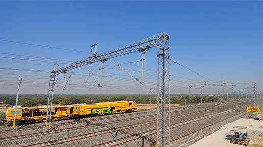
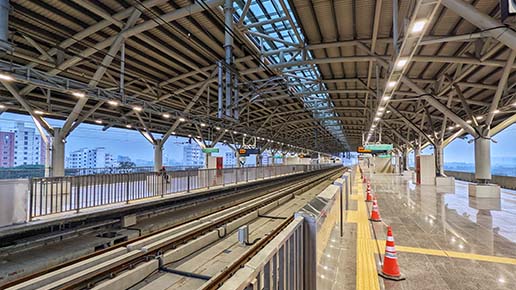
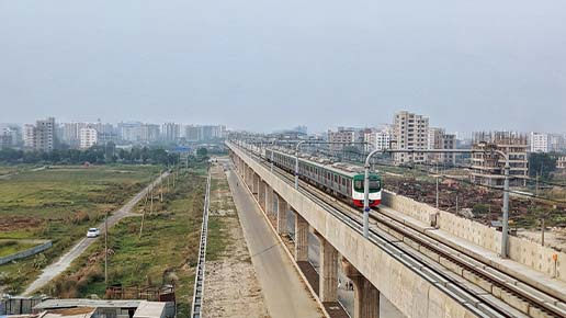
- Transportation Infrastructure: Roads, public transportation, metro and rail networks, pedestrian infrastructure, cycling infrastructure and transit connectivity together determine how easily people and goods move through a city. Congestion is rarely a roads problem on its own — usually it’s a sign that these systems were never planned as one network.
- Water Infrastructure: Water supply, treatment, distribution, storage and conservation form the backbone of urban water security. This is a discipline in its own right, and our Water Resources Engineering guide covers how supply systems get assessed, designed and operated in far more depth.
- Wastewater & Drainage Infrastructure: Sewerage, stormwater drainage, flood control and wastewater treatment protect public health and equip a city with a chance to withstand downpours without its streets and homes being submerged.
- Energy Infrastructure: Electricity grids, renewable energy integration, distributed energy resources, and energy efficiency measures determine whether a burgeoning city can realistically “keep the lights on” reliably. Check out our blog on Renewable Energy Engineering for more insights.
- Solid Waste Infrastructure: Collection, transfer, treatment, recycling and disposal units either keep up with the escalating volumes of waste generated by cities or they don’t, and this sector is inevitably among the most under-planned in relation to the impact on public health.
- Digital infrastructure: Connectivity, IoT networks, smart sensors, data systems, and digital platforms are now foundational for just about every other system on this list, providing the monitoring and coordination that modern infrastructure planning depends on.
- Social & Public Infrastructure: Healthcare institutions, schools, emergency services and public realms add the final finishing touch to the picture — infrastructure in the more expansive term, and just as critical to a well-working city as the pipes and roads underneath it.
Types of Urban Infrastructure
Urban infrastructure covers the essential systems and services that keep cities connected, functional and livable. Each infrastructure type serves a specific purpose and supports different aspects of urban life.
Infrastructure | Primary Purpose | Examples |
Transportation | Mobility | Roads, metro, rail |
Water | Water security | Supply, treatment, storage |
Wastewater & Drainage | Public health & flood control | Sewers, drains |
Energy | Reliable power | Grid, renewable energy |
Waste | Resource & waste management | Recycling, treatment |
Digital | Connectivity & city management | IoT, data platforms |
Public Infrastructure | Quality of life | Schools, healthcare, public spaces |
What Are the Principles of Urban Infrastructure Planning?
A handful of core principles show up across almost every well-run urban infrastructure planning process, regardless of city size or project type. They shape how decisions get made long before construction begins.
- Integrated Planning — Different infrastructure systems should be planned together rather than independently; a road widening that ignores the drainage line beneath it is a problem waiting to surface, often literally.
- Long-Term Planning — Infrastructure has to account for population and demand that doesn’t exist at the time of design; plan for the city a decade or two out, not the one standing today.
- Sustainability — Reduce resource consumption and environmental impact at every stage, from material selection through decades of operation.
- Accessibility and Inclusion — Infrastructure should serve different communities and user groups equitably, not just the neighborhoods with the loudest advocacy.
- Climate Resilience — Plan for floods, heat, water stress and other climate risks as design inputs, not afterthoughts bolted on once a system’s already built.
- Resource Efficiency — Optimize land, water, energy and financial resources, all of them scarce, all of them competing for the same budget line.
- Connectivity — Ensure infrastructure systems connect effectively across the city and the wider region, since few urban problems stay within municipal boundaries.
- Economic Viability — Consider lifecycle costs, investment requirements and long-term maintenance, not just the capital cost of construction.
Principles of Urban Infrastructure Planning – At a Glance
Effective urban infrastructure planning should balance present needs with long-term growth. These principles help cities build systems that are efficient, sustainable, resilient and accessible to all communities. Here are the principles of urban infrastructure planning for you to look at:
Principle | Planning Objective |
Integration | Coordinate infrastructure systems |
Sustainability | Reduce environmental impact |
Resilience | Prepare for future risks |
Inclusion | Serve diverse communities |
Efficiency | Optimize resources |
Connectivity | Improve movement and access |
Lifecycle Thinking | Consider long-term performance |
Economic Viability | Support financially sustainable development |
What Is the Urban Infrastructure Planning Process?
The process moves through a consistent sequence, whatever the city’s scale:
- Existing conditions — Population, land use, infrastructure capacity, current services and environmental conditions set the baseline everything else is measured against.
- Future demand — Population projections, economic growth, land-use changes, mobility patterns, and water and energy needs shape what’s coming.
- Gap analysis — Existing capacity gets compared against future demand, and the difference is where the real planning work begins.
- Planning objectives — Usually anchored around better mobility, water security, climate resilience and improved public services.
- Infrastructure strategies — Laying out what’s needed, where, and on what timeline.
- Evaluation of alternatives — Weighed against technical feasibility, environmental impact, economic viability and social implications before anything gets locked in.
- Prioritization — Projects ranked by urgency, impact, cost, feasibility and population served, since almost no city can afford to build everything at once.
- Implementation planning — Turns the chosen strategy into an actual delivery plan, covering phasing, financing, responsibilities and timelines.
- Monitoring and updating — Never really stops, since population shifts, technology moves on, climate conditions change and performance data keeps arriving.
A plan nobody revisits stops being a plan and becomes a historical document instead.
Key Stages of Urban Infrastructure Planning
Urban infrastructure planning follows a structured process to understand current conditions, anticipate future needs and determine which projects should be prioritized and delivered. The key stages include:
Stage | Key Question |
Existing Conditions | What infrastructure exists today? |
Demand Assessment | What will the city need tomorrow? |
Gap Analysis | Where are the deficiencies? |
Planning | What infrastructure is required? |
Evaluation | Which solutions are most suitable? |
Prioritization | What should be implemented first? |
Implementation | How will projects be delivered? |
Monitoring | Is infrastructure meeting its objectives? |
How Is Infrastructure Planned for Growing Cities?
Fast-growing cities run through the same planning process as any other city, just under real time pressure. It typically covers:
- Population forecasting — Projecting how many people the city will house, and where, over the next decade or more.
- Urban expansion patterns — Tracking which direction and how fast the built-up area is spreading.
- Land-use planning — Matching zoning and development to where infrastructure can realistically reach.
- Infrastructure capacity — Checking existing systems against the load a larger population will place on them.
- Transport demand — Estimating how commuting and mobility needs will shift as the city grows.
- Water demand — Projecting supply and distribution needs ahead of new development.
- Energy demand — Sizing grid capacity for a population and industrial base that hasn’t arrived yet.
- Public-service requirements — Planning schools, healthcare and emergency services alongside physical infrastructure.
- Future development corridors — Identifying where growth is headed next, before it happens.
Everything on that list has to move faster than it would in a stable, slow-growing city.
The idea worth holding onto is simple: Plan infrastructure ahead of demand, not after infrastructure becomes inadequate. Cities that wait for congestion, water shortages or flooding to become visible before responding are always building from behind. Infrastructure built under crisis conditions tends to cost more and perform worse than infrastructure built on a forecast.
How Does Sustainable Infrastructure Fit Into Urban Planning?
Sustainability isn’t bolted onto urban infrastructure planning as a separate layer — it’s one of the principles the discipline is built around, and in practice that means design choices made at the planning stage rather than retrofits applied later:
- Energy efficiency — Lower-consumption systems designed in from the start, rather than upgraded later.
- Renewable energy integration — Solar, wind and other distributed generation built into the energy plan rather than added on.
Promoting sustainable infrastructure creates room to bring environmental, economic and social considerations together in infrastructure design, development and planning. It’s best understood as the backdrop against which all urban infrastructure planning and design happens, not a separate box to check.
India’s Urban Infrastructure Landscape
India’s urban infrastructure story is shaped by the sheer pace of its urbanization. Metropolitan regions are expanding quickly, often faster than the infrastructure meant to support them, and the pressure shows up across nearly every system at once:
- Transportation — Public transportation networks are being extended and modernized across major and secondary cities alike, as metro and rail projects work to keep pace with commuting demand.
- Water and sanitation — Demand keeps rising even as distribution infrastructure in many areas hasn’t kept pace with population growth.
- Drainage and flooding — Urban flooding has become a recurring seasonal concern in cities where drainage systems were designed for a smaller, less paved footprint.
- Digital infrastructure — Smart city initiatives and digital infrastructure investment are expanding, aimed partly at closing the gap between infrastructure capacity and real-time demand.
- Climate resilience — It has shifted from an optional consideration to a standard design requirement across new projects.
How Does Climate Resilience Affect Urban Infrastructure Planning?
Climate risk has moved from a long-range planning consideration to a near-term design requirement. The planning response typically includes:
- Improved drainage systems — Capacity upgraded to handle rainfall intensities beyond historical records.
- Flood-resilient infrastructure — Critical systems designed or relocated to withstand and recover from flooding.
- Heat-resilient urban design — Materials, shading and green cover chosen to reduce urban heat buildup.
- Water conservation measures — Supply systems designed to hold up through longer or more frequent droughts.
- Nature-based solutions working alongside engineered systems — Wetlands and floodplain restoration reducing the load on built infrastructure.
- Dedicated emergency infrastructure — Systems built specifically to keep functioning during climate-driven disruptions.
- Deliberate redundancy built into systems that used to run with none — Backup capacity so a single point of failure doesn’t take down an entire network.
What Role Does Technology Play in Urban Infrastructure Planning?
Digital tools have reshaped how infrastructure gets assessed, designed and monitored, closing gaps that used to take years of manual survey work to identify.
GIS
Land-use mapping, infrastructure mapping, spatial analysis and network planning all run on GIS today, giving planners a spatial view of a city’s systems that used to require piecing together from disconnected records.
Remote Sensing
Monitoring urban growth, tracking land-use change and assessing the environment are all reliant on satellite and airborne data, particularly in areas where cities are growing faster than ground surveys can keep up.
IoT and Sensors
Monitoring traffic, water, energy and infrastructure conditions is increasingly being done in near real time, allowing these small ills to be caught and remedied while still small and cheap to fix.
Digital Twins
Infrastructure visualization, “what if” scenario modeling, and asset management are supported by virtual models of city systems that enable planners to experiment with changes prior to implementing those changes in the field.
Data Analytics
Demand forecasting, traffic modeling, risk analysis, and predictive maintenance are increasingly leveraging structured data analysis, converting years of sensor and survey data into actionable decisions, rather than data to be filed away in cabinets.
What Are the Benefits of Urban Infrastructure Planning?
Wondering about the benefits of urban infrastructure planning? Check out these:
Outcome | How Planning Helps |
Better Mobility | Coordinates transport networks |
Water Security | Plans capacity and distribution |
Flood Resilience | Integrates drainage and risk planning |
Efficient Investment | Prioritizes infrastructure projects |
Sustainability | Reduces resource consumption |
Better Quality of Life | Improves access to essential services |
Economic Growth | Supports businesses and development |
Resilience | Prepares cities for future risks |
What Are the Challenges of Urban Infrastructure Planning?
Even well-run planning processes run into the same recurring obstacles. Here are the ones that show up most often, along with the practical response to each.
1. Rapid Urbanization
Infrastructure demand can grow faster than planning cycles — the response is shorter, more iterative planning horizons rather than a single fixed master plan.
2. Fragmented Infrastructure Systems
Transport, water, energy and drainage are often planned independently by separate agencies. Integrated planning frameworks and shared data are the practical fix.
3. Limited Funding
Cities must prioritize competing infrastructure needs against finite budgets — which makes rigorous project prioritization, not just good design, a core planning skill.
4. Land Constraints
Limited urban land creates conflicts between infrastructure and other uses. Vertical and shared-corridor infrastructure solutions increasingly ease this pressure.
5. Climate Uncertainty
Future climate conditions are difficult to predict precisely. Scenario-based planning, rather than a single forecast, is the standard response.
6. Data Gaps
Poor or outdated data weakens planning decisions at every stage. Investment in monitoring and digital infrastructure pays for itself here.
7. Stakeholder Coordination
Multiple agencies and communities need to be aligned, and misalignment is one of the most common reasons infrastructure projects stall after approval.
8. Maintenance and Lifecycle Management
Infrastructure planning has to consider long-term operation, not just construction — a system that isn’t maintained degrades far faster than its design life suggests.
Urban Infrastructure Planning in India
India’s urban infrastructure story is shaped by the sheer pace of its urbanization. Metropolitan regions are expanding quickly, often faster than the infrastructure meant to support them, and the pressure shows up across nearly every system at once:
- Transportation — Public transportation networks are being extended and modernized across major and secondary cities alike, as metro and rail projects work to keep pace with commuting demand.
- Water and sanitation — Demand keeps rising even as distribution infrastructure in many areas hasn’t kept pace with population growth.
- Drainage and flooding — Urban flooding has become a recurring seasonal concern in cities where drainage systems were designed for a smaller, less paved footprint.
- Digital infrastructure — Smart city initiatives and digital infrastructure investment are expanding, aimed partly at closing the gap between infrastructure capacity and real-time demand.
- Climate resilience — It has shifted from an optional consideration to a standard design requirement across new projects.
- Integrated planning — Increasingly the stated goal of government infrastructure programs, treating transport, water, energy and drainage as one coordinated system, even where implementation still has ground to cover.
The relevant ministries of the Government of India, NITI Aayog, the World Bank and the Asian Development Bank, among others, continue to influence funding and policy direction for urban infrastructure development planning in the country. That places India among the more dynamic — and closely watched — markets for this discipline worldwide.
The Future of Urban Infrastructure Planning
The field is eschewing one-time masterplans for ongoing, technology-enabled strategies that evolve as cities evolve. Here’s where that shift is headed next.
Mapping the Information City
Planning decisions are based on data, not just historical assumptions.
Smart Infrastructure
Self-monitoring performance sensor-enabled systems are becoming a basic expectation rather than an optional feature.
Digital Twins
Virtual city planners can run infrastructure simulations before laying down capital on the ground.
Climate-Resilient Cities
Design standards are shifting toward a range of future climate scenarios rather than historical weather records.
Integrated Mobility
Transport planning is converging across modes — road, rail, transit and active mobility — into single coordinated networks.
Nature-Based Infrastructure
Wetlands, urban forests, and permeable surfaces are now more commonly designed in conjunction with engineered systems rather than as decoration around them.
Decentralized Energy and Water Systems
Decentralized energy production, and local water treatment are diminishing reliance on monolithic, centralized networks.
Predictive, Data-Driven Infrastructure Planning
Predictable performance and dot forecasting are used to predict maintenance requirements and demand changes a long time before failure.
Circular Infrastructure
Waste, water and materials are increasingly designed to loop back into city systems rather than exit them as one-way outputs.
The future of urban infrastructure planning is shifting from isolated project planning toward integrated, data-driven and resilient planning of interconnected urban systems.
What Is the Role of Engineering and Planning Consultants?
Few urban infrastructure projects get delivered by a single team working in isolation. Consultants typically support the full lifecycle:
- Infrastructure needs assessment — Establishing what a city actually requires before any design work begins.
- Master planning — Setting the overall framework that individual infrastructure projects fit into.
- Feasibility studies — Testing whether a proposed project is technically, environmentally and financially viable.
- Demand forecasting — Projecting future population and infrastructure load to size systems correctly.
- Technical studies — The detailed hydrological, traffic, environmental and engineering analysis behind each project.
- Engineering design — Turning strategy into buildable, specified infrastructure.
- Environmental and social assessment — Evaluating impact on communities and ecosystems before construction starts.
- Infrastructure prioritization — Ranking projects against urgency, cost and impact under real budget constraints.
- Project preparation — Packaging projects for approval, financing and procurement.
- Implementation support — Keeping construction aligned with the approved design as it happens.
- Ongoing monitoring and evaluation — Tracking whether infrastructure performs as intended long after delivery.
This end-to-end involvement matters because urban infrastructure projects rarely fail at the design table — they tend to fail when demand assessment gets rushed, stakeholder coordination breaks down mid-project, or implementation quietly drifts from the approved plan before anyone catches it. An experienced urban infrastructure planning consultant brings the cross-disciplinary view that keeps transport, water, energy and drainage decisions aligned with each other, rather than solved one silo at a time.
NK India supports urban infrastructure planning projects across this full spectrum — from initial needs assessment and master planning through detailed engineering, environmental review and long-term monitoring — working alongside city and regional agencies as an urban infrastructure planning consultant engaged from the earliest planning stage through delivery. For projects requiring that kind of integrated support, our Urban & Regional Development team is the natural next step.
Conclusion
Urban infrastructure planning sits between a city’s present-day systems and the version of that city population growth, climate risk and rising demand are already shaping. It starts with an honest read of existing conditions and future need, and runs through transport, water, energy, drainage and digital transformation planned as one coordinated whole rather than a string of separate projects.
Cities that treat this as a one-time exercise tend to fall behind their own growth. Cities that build it into an ongoing process — reassessed as population shifts, technology develops and climate conditions change — are the ones that stay ahead of it. That’s the work: feasibility studies, integrated design, prioritization under real budget constraints, and monitoring that continues long after a project is delivered. NK India brings this expertise to urban infrastructure planning projects from initial assessment through implementation and beyond. Talk to NK India about your next urban infrastructure planning project.



 NKIProMIS
 ERP
ERP Ascent
 Office
 PMIS
PMIS

